| Environment |
|
|
|
Chapter 1OVERVIEW OF THE HIGHWAY | |
|
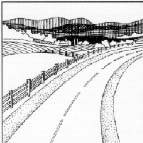
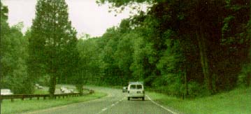
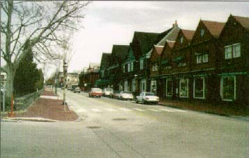
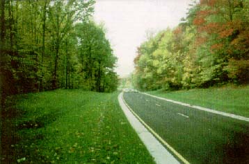
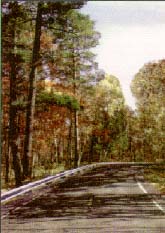
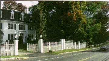
A successful process includes designer and community involvement from the beginning. (Rt. 123/124 in New Ipswich Village, NH) |
 |
|
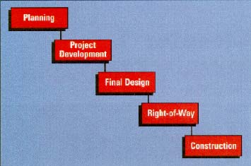
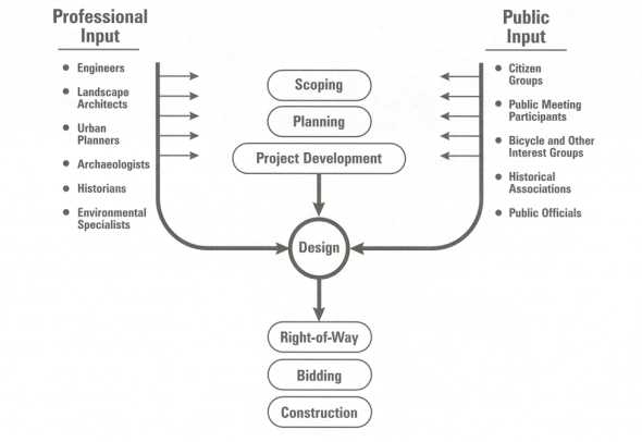
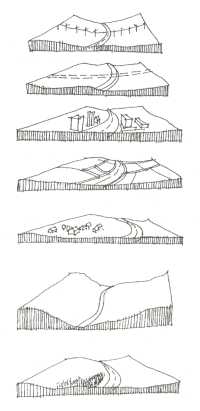
Highway design is only one element in the overall highway development process. Historically, detailed design occurs in the middle of the process, linking the preceding phases of planning and project development with the subsequent phases of rightofway acquisition, construction, and maintenance. While these are distinct activities, there is considerable overlap in terms of coordination among the various disciplines that work together, including designers, throughout the process.
It is during the first three stages, planning, project development, and design, that designers and communities, working together, can have the greatest impact on the final design features of the project. In fact, the flexibility available for highway design during the detailed design phase is limited a great deal by the decisions made at the earlier stages of planning and project development. This Guide begins with a description of the overall highway planning and development process to illustrate when these decisions are made and how they affect the ultimate design of a facility. THE STAGES OF HIGHWAY DEVELOPMENT Although the names may vary by State, the five basic stages in the highway development process are: planning, project development (preliminary design), final design, rightofway, and construction. After construction is completed, ongoing operation and maintenance activities continue throughout the life of the facility.
Planning
The initial definition of the need for any highway or bridge improvement project takes place during the planning stage. This problem definition occurs at the State, regional, or local level, depending on the scale of the proposed improvement. This is the key time to get the public involved and provide input into the decisionmaking process. The problems identified usually fall into one or more of the following four categories:
Whichever problem (or set of problems) is identified, it is important that all parties agree that the problem exists, pinpoint what the problem is, and decide whether or not they want it fixed. For example, some communities may acknowledge that a roadway is operating over its capacity but do not want to improve the roadway for fear that such action will encourage more growth along the corridor. Road access may be a problem, but a community may decide it is better not to increase access,
Obtaining a community consensus on the problem requires proactive public involvement beyond conventional public meetings at which welldeveloped design alternatives are presented for public comment. If a consensus cannot be reached on the definition of the problem at the beginning, it will be difficult to move ahead in the process and expect consensus on the final design. Planning Occurs at Three Government Levels State Planning. At the State level, State DOTS are required to develop and maintain a statewide, multimodal transportation planning process. Broad categories of highway improvement needs are defined, based primarily on ongoing examinations of roadway pavement conditions and estimates of presentday and 20year projections of traffic demands. In addition, each State is required to conduct biennial inspections of its major bridges (and similar, less frequent, inspections of minor structures) to determine their structural adequacy and capacity. In a number of States, regional transportation plans for multiple counties are prepared within the context of the statewide planning process. Every few years, the State selects improvement projects based on the longrangeplan and includes them in the Statewide Transportation Improvement Program, or STIP. Regional Planning. State efforts are supplemented in urbanized areas with a population of more than 200,000 through the metropolitan transportation planning process. Metropolitan planning organizations (MPOs) develop their own regional plans, unlike nonMPO areas, which must rely on the State planning process. The metropolitan planning process requires the development of a longrange plan, typically prepared with a 20 to 25year planning horizon. The plan not only defines a region's multimodal transportation needs, but also identifies the local funding sources that will be needed to implement the identified projects. Each urbanized area or MPO then uses this information to prepare a shorter, more detailed listing and prioritization of projects for which work is anticipated within the next 3 to 5 years. The listing of these projects is referred to as the shortrange Transportation Improvement Program, or TIP The TIP is incorporated into the STIP
Local Planning. Most cities and counties follow a similar process of project identification, conceptual costing, and prioritization of the roadways for which they are responsible. Generally, these are roads that are not the responsibility of the State DOT. However, the State must work with localities to get their input into the longrange plan and STIP
Factors To Consider During Planning
It is important to look ahead during the planning stage and consider the potential impact that a proposed facility or improvement may have while the project is still in the conceptual phase. During planning, key decisions are made that will affect and limit the design options in subsequent phases. Some questions to be asked at the planning stage include:
Answers for such questions are found in planninglevel analysis, as well as in public involvement during planning.
PROJECT DEVELOPMENT
After a project has been planned and programmed for implementation, it moves into the project development phase. At this stage, the environmental analysis intensifies. The level of environmental review varies widely, depending on the scale and impact of the project. It can range from a multiyear effort to prepare an Environmental Impact Statement (a comprehensive document that analyzes the potential impact of proposed alternatives) to a modest environmental review completed in a matter of weeks. Regardless of the level of detail or duration, the product of the project development process generally includes a description of the location and major design features of the recommended project that is to be further designed and constructed, while continually trying to avoid, minimize, and mitigate environmental impact.
The basic steps in this stage include the following:
In general, decisions made at the project development level help to define the major features of the resulting project through the remainder of the design and construction process. For example, if the project development process determines that an improvement needs to take the form of a fourlane divided arterial highway, it may be difficult in the design phase to justify providing only a twolane highway. Similarly, if the project development phase determines that an existing truss bridge cannot be rehabilitated at a reasonable cost to provide the necessary capacity, then it may be difficult to justify keeping the existing bridge without investing in the cost of a totally new structure.
Scoping
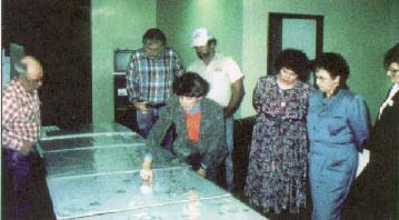
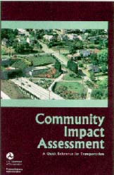
Just as in planning, there are many decisions made during the scoping phase of project development, regardless of the level of detail being studied. Therefore, it is important that the various stakeholders in the project be identified and provided with the opportunity to get involved (see Figure 1.3). Agency staff can identify stakeholders by asking individuals or groups who are known to be interested or affected to identify others and then repeat the process with the newly identified stakeholders. A good community impact assessment will also help identify stakeholders and avoid overlooking inconspicuous groups. The general public should not be omitted, although a different approach is usually needed with the general public than with those who are more intensely interested. The Federal Highway Administration (FHWA) has recently published a guide entitled, Community Impact Assessment: A Quick Reference for Transportation, that describes this community impact assessment process. Assessing the Character of an Area
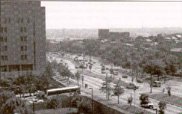
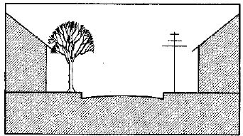
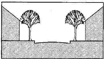
In order for a designer to be sensitive to the project's surrounding environment, he or she must consider its context and physical location carefully during this stage of project planning. This is true whether a house, a road, a bridge, or something as small as a bus passenger waiting shelter is to be built. A data collection effort may be needed that involves site visits and contacts with residents and other stakeholders in the area. A benefit of the designer gathering information about the physical character of the area and the values of the community is that the information will help the designer shape how the project will look and identify any physical constraints or opportunities early in the process (see Figure 1.4).
Some of the questions to ask at this stage include:
FINAL DESIGN After a preferred alternative has been selected and the project description agreed upon as stated in the environmental document, a project can move into the final design stage. The product of this stage is a complete set of plans, specifications, and estimates (PS&Es) of required quantities of materials ready for the solicitation of construction bids and subsequent construction. Depending on the scale and complexity of the project, the final design process may take from a few months to several years.
The need to employ imagination, ingenuity, and flexibility comes into play at this stage, within the general parameters established during planning and project development. Designers need to be aware of designrelated commitments made during project planning and project development, as well as proposed mitigation. They also need to be cognizant of the ability to make minor changes to the original concept developed during the planning phase that can result in a "better" final product.
The interests and involvement of affected stakeholders are critical to making design decisions during this phase, as well. Many of the same techniques employed during earlier phases of the project development process to facilitate public participation can also be used during the design phase.
The following paragraphs discuss some important considerations of design, including:
Using the concept approach helps to achieve a holistic design for the project. Using the surrounding context and public input to guide the development of the concept helps to ensure that the project is in harmony with its surroundings and that the elements of the project are in harmony with each other.
An excellent example of a holistic design approach is the Merritt
Parkway in Connecticut. Designed and built in the 1930's, its overall
design philosophy was to build a graceful highway set in a natural
environment. This was achieved by using long, gradual vertical curves,
rounding out rockcuts to produce a natural appearance, and most important,
integrating the traveled way into the terrain through choice of alinement
and a carefully planned landscape. The result was a highway that not only
met traffic demand, but was also a scenic escape for inhabitants of the
urbanized areas it served.
Traveling along the 61km (38mile) route today, it's easy to see how all the elements of the roadway fit together to achieve this parkway concept. The setting, with its vegetation, appears natural. The pavement width is minimal; opposing traffic is separated by a grass median and most shoulders are covered with grass. Despite the population growth that has developed around the parkway, and in many cases directly up to the parkway, the density of trees and the carefully planned topography hide this development from view. One of the most striking features of the parkway is its bridges. There are 72 in all (35 of which carry intersecting crossroads over the parkway), and each is designed differently. Even the materials used vary considerably, from stone to concrete to steel, yet they all work together, because they are all designed within the same scale. They are all approximately the same length and height, which gives the appearance that they all belong together, despite the fact that some are arch construction and some post and beam.
For existing roads, where improvements may only involve a small section of the road, there may not be the need to develop an entirely new concept for the roadway. In fact, it would probably be inappropriate to do so, because the result would be that one small section of the roadway looked much different than the rest. It is important in these cases to be consistent with the existing design of the overall route, using the information gathered to assess the character of the area and to design with sensitivity to that character.
An exception might be when the environment of the road changes along a short section. For instance, a rural collector may change characteristics as it enters a town and becomes an urban street for a few blocks, then changes back to a rural collector. Designers working on the urban section of the street do not have to be consistent with the look of the road outside the urban environment, because its character is so different. Both the urban and rural sections should, however, maintain the same general scale in terms of roadway width. Considering Scale
People driving in a car see the world at a much different scale than people walking on the street. This large discrepancy in the design scale for a car versus the design scale for people has changed the overall planning of our communities. For example, it has become common in many suburban commercial areas that a shopper must get in the car and drive from one store to the next. Except in the case of strip malls, stores are often separated by large parking lots and usually have no safe walkways for pedestrians. This makes it difficult to get around any other way but by car. This type of design scale is in sharp contrast to preautomobile commercial areas that commonly took the form of "main streets," where walking from one store to the next ,was the norm.
Trying to accommodate users of the road who have two different design scales is a difficult task for designers; however, designers must always consider the safety of pedestrian and nonvehicular traffic, along with the safety of motorists. Both are users of the road. In many road designs, pedestrian needs were considered only after the needs of motorized vehicles. Not only does this make for unsafe conditions for pedestrians, it can also drastically change how a roadway corridor is used. Widening a roadway that once allowed pedestrian access to the two sides of the street can turn the roadway into a barrier and change the way pedestrians use the road and its edges.
The design element with the greatest effect on the scale of the roadway is its width, or cross section. The cross section can include a clear zone, shoulder, parking lanes, travel lanes, and/or median. The wider the overall roadway, the larger its scale; however, there are some design techniques that can help to reduce the perceived width and, thus, the perceived scale of the roadway. Limiting the width of pavement or breaking up the pavement is one option. In some instances, fourlane roadways may look less imposing by designing a grass or planted median in the center. Grass shoulders, such as those often used in many parts of the southeastern United States, limit the perceived width of the roadway and still provide a breakdown area for motorists. These types of shoulders may be appropriate, depending on the context of the area; volume, type, and speed of traffic; and the needs of pedestrians and bicyclists. Green space between sidewalks or nonmotorized vehicle paths and the travel lanes also helps to break up the perceived width of the pavement.
Elements (or a lack of elements) along the roadside also contribute to
the perceived width of the road and can even affect the speed at which
motorists travel. With all else being equal, the wider the perceived road,
the faster motorists will travel. Along with horizontal and vertical
alinement, crosssection elements, and other elements, such as vegetation
along the roadway, buildings close to the road, onstreet parking, and even
noise walls, may contribute to reducing the perceived width and speed of
the road. Considering these elements is important in designing a facility
that is compatible with its surroundings.
Detailing the Design
Particularly during the final design phase, it is the details associated with the project that are important. Employing a multidisciplinary design team ensures that important design details are considered and that they are compatible with community values. Often it is the details of the project that are most recognizable to the public. A special type of tree that was used as part of the landscape plan, antique lighting, brick sidewalks, and ornamental traffic barriers are all elements of a roadway that are easily recognizable and leave an impression. Because of their visibility, the treatment of details is a critical element in good design.
For instance, the stonewall appearance of the traffic barriers on the BaltimoreWashington Parkway is one of the first elements noticed by drivers using that route. If a plain concrete barrier had been used instead, the overall appearance of the parkway would change considerably. A design that requires no traffic barriers whatsoever may be considered even more aesthetically pleasing than improved barrier designs, even if they are given a pleasing design treatment.
I35E, which passes through downtown St. Paul, MN, incorporated many design elements (such as ornate bridge rails and lighting, planted medians, and street furniture) to achieve the identified project goals of integrating the freeway into the urban environment, designing a gateway into downtown, providing pedestrian access, and reflecting the history and character of the area.
Such features as traffic barriers (or the lack of traffic barriers), bridge rails, and the treatment of overpasses, medians, and landscape development should be integral parts of the design process, not left to the end or forgotten entirely.
RIGHTOFWAY, CONSTRUCTION, AND MAINTENANCE
Once the final designs have been prepared and needed rightofway is purchased, construction bid packages are made available, a contractor is selected, and construction is initiated. During the rightofway acquisition and construction stages, minor adjustments in the design may be necessary; therefore, there should be continuous involvement of the design team throughout these stages. Construction may be simple or complex and may require a few months to several years. Once construction has been completed, the facility is ready to begin its normal sequence of operations and maintenance.
Even after the completion of construction, the character of a road can be changed by inappropriate maintenance actions. For example, the replacement of sections of guardrail damaged or destroyed in crashes commonly utilizes whatever spare guardrail sections may be available to the local highway maintenance personnel at the time. The maintenance personnel may not be aware of the use of a special guardrail design to define the "character" of the highway. When special design treatments are used, ongoing operation and maintenance procedures acknowledging these unusual needs should be developed. For example, the Oregon DOT has developed a special set of maintenance procedures for its scenic and historic highways.
ELEMENTS OF A SUCCESSFUL PROCESS
Table 1.1 summarizes the five basic stages in highway planning and development.
In other words, a successful highway design process includes the following:
Some of these elements are discussed in the following paragraphs.
Public Involvement. A successful highway process includes public involvement. To be effective, public involvement must be sought from the beginning, during the definition of need for the project. The public should be involved while there are the greatest opportunities for changes in the design. This will result in a smoother and faster process.
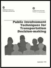
Public input can also help in assessing the characteristics of the area and determining what physical features are most valued by the community, thus having the greatest potential for impact. Knowing the features of an area are valued may help designers avoid them altogether and reduce the need for mitigation and the likelihood for controversy. After working with the community to define the project and assess the physical character, continuous public involvement is important to gain input on possible alternatives. Identifying community values, defining the project need with the public, gathering information on the area, and solving design conflicts with the public necessitate a proactive public involvement effort going far beyond the usual presentation of welldeveloped design alternatives at formal public meetings and hearings. For example, by using a workshop meeting format early in project design, highway designers can ask members of the public to identify types of design features that they find appealing or unappealing. In September 1996, the FHWA and the Federal Transit Administration (FTA) issued Public Involvement Techniques for Transportation Decisionmaking, which describes a wide variety of these innovative public involvement techniques.'
Visualization Tools. The most effective communication between two parties takes place when both speak the same language. This can be achieved in design using illustrations that show the public what a project will look like before it is built. Increasingly, computergenerated visualization tools are being used for this purpose. Designers can communicate conceptually what they are planning for an area, and citizens can react with a certain degree of confidence that they understand what is being communicated to them. Lower end computer systems use a photograph taken of the existing project area and superimpose a drawing, using computer graphics, of what the new construction will look like. Visualization tools, such as these, help the public gain a better understanding of the proposed improvement project.
REFERENCES
Public Involvement Techniques for Transportation Decisionmaking helps highway designers who are seeking ways to enable the public to contribute constructively to planning and design issues. The project presentations and statements from the public during traditional public meetings and public hearings are often more conducive to taking stands than to solving difficult design issues. This publication offers both highway designers and citizens a wealth of specific ideas and contacts for more information in the following topic areas:
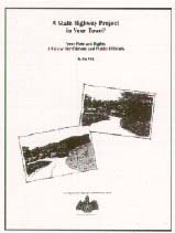
A State Highway Project in Your Town? Your Roles and Rights: A Primer for Citizens and Public Officials, by Vermont architect Jim Wick, also approaches highway design from a different viewpoint. Although written specifically for citizens and public officials in the State of Vermont, all will find this handbook useful for gaining a better understanding of the highway planning and design process. It gives tips for how communities can get involved so that towns can achieve the kinds of road projects they want. Included in the handbook are the following sections:
Copies of this booklet are available from the Preservation Trust of Vermont, 104 Church Street, Burlington, VT 05401. |
|
|
|