| Environment |
|
|
|
|
One of the first steps in the design process is
determining the functional classification of a facility. |
Chapter 3FUNCTIONAL CLASSIFICATIONRefer to Chapter I of the AASHTO Green Book |
 |
|
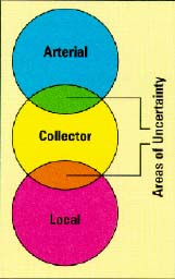
BACKGROUND Functional classification is the process by which streets and highways are grouped into classes, or systems, according to the character of traffic service that they are intended to provide. There are three highway functional classifications: arterial, collector, and local roads. All streets and highways are grouped into one of these classes, depending on the character of the traffic (i.e., local or long distance) and the degree of land access that they allow. These classifications are described in Table 3.1. |
The Functional Classes:
|
| Each type of road has a specific purpose or function. |
|
Table 3.1 Functional Classification Systems |
|
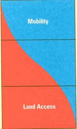
Typically, travelers will use a combination of arterial, collector, and local roads for their trips. Each type of road has a specific purpose or function. Some provide land access to serve each end of the trip. Others provide travel mobility at varying levels, which is needed en route. There is a basic relationship between functionally classified highway systems in serving traffic mobility and land access, as illustrated in Figure 3.1. Arterials provide a high level of mobility and a greater degree of access control, while local facilities provide a high level of access to adjacent properties but a low level of mobility. Collector roadways provide a balance between mobility and land access.
The Role of Functional Classification in the Design Process The AASHTO Green Book explicitly recognizes the relationship between highway functional classification and design criteria. State, county, and city highway design manuals likewise relate design criteria to highway functional classification. The AASHTO Green Book states:
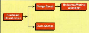
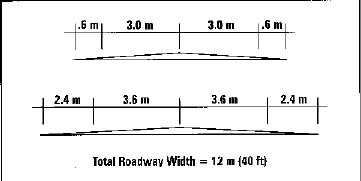
Once the functional classification of a particular roadway has been established, so has the allowable range of design speed. With the allowable range of design speed defined, the principal limiting design parameters associated with horizontal and vertical alinement are also defined. Similarly, a determination of functional classification establishes the basic roadway cross section in terms of lane width, shoulder width, type and width of median area, and other major design features (see Figure 3.2).
The importance of the functional classification process as it relates to highway design lies in the fact that functional classification decisions are made well before an individual project is selected to move into the design phase. Moreover, such decisions are made on a systemwide basis by city, county, or State DOTS or MPOs as part of their continuing longrange transportation planning functions. Such systematic reassessments are typically undertaken on a relatively infrequent basis. Thus, the functional classification of a particular section of highway may well represent a decision made 10 or more years ago. Even after the decision has been made to functionally classify a highway section, there is still a degree of flexibility in the major controlling factor of design speed. Table 3.2, excerpted from the 1995 edition of the Roadway Design Manual of the Virginia DOT, illustrates the manner in which one state has related a range of allowable design speeds to different roadway functional classifications.
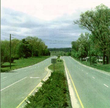
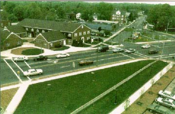
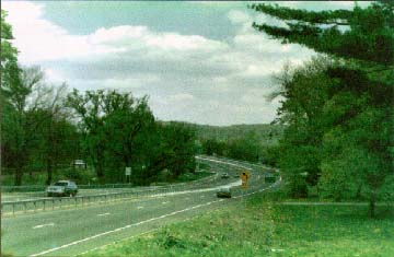
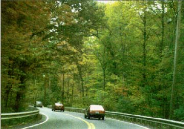
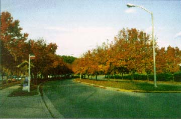
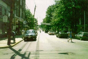
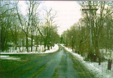
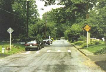
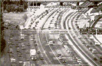
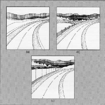
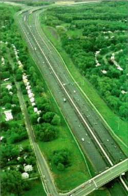
It is important to remember that there are no "cookiecutter" designs for arterial highways or collector streets. Because of the range of geometric design options available, arterials and collectors can vary considerably in appearance, as shown in the following photographs
Current Highway Functional Classifications The highway system of the United States consists of slightly over 6.3 million km (3.9 million miles) of road.' Of this total, 5.0 million km (3.1 million miles) are located in rural areas, and the remaining 1.3 million km (800,000 miles) are urban streets. Each of these rural and urban streets has been given a specific functional classification, as illustrated in Table 3.3. In terms of jurisdictional responsibility, about 5 percent of the total is administered by the Federal Government, approximately 16 percent is under State control, and the remaining 79 percent is under the control of county and local governments.
ISSUES The Need To Update Highway Functional Classifications Traffic service patterns on a roadway and the roadway's function can change over time. If the functional classification system for a specific jurisdiction is not updated on a regular basis, roadways may be designed using inappropriate design standards. Solution Clearly, there is a need to reevaluate a locality's functional classification system on a relatively frequent and regular basis to ensure that the functional classification of any particular route accurately reflects the traffic function of the route now and in the foreseeable future. This continuing reassessment process can be viewed as an application of design flexibility even before the decision is made to begin designing a particular project. The decision to change the functional classification should be made based on careful review of changed conditions and sound reasoning. The Functional Classification Process Is Not an Exact Science
The Impact of Land Use Changes on Road Functions Land use is an important determinant of the function of an area's roads. As land use changes because of development, especially at the urban fringe, road functions also change. It is not uncommon for roads that once served as rural local access routes to farmland, and now serve suburban residential subdivisions and commercial land uses, to be reclassified as urban collectors or arterials depending on the intensity of development and the type of traffic generated by the development. Design standards or guidelines must change to meet actual or impending change in traffic character and road function. Actions taken by a local jurisdiction to control or direct the form and
location of growth or to preserve the current physical and scenic
characteristics of a highway corridor should also reflect the need for a
reexamination of existing functional classification and, perhaps, even a
change in jurisdictional responsibility (see Figure 3.5). For example, the
construction of a new controlledaccess bypass route might allow for a
downward reclassification of what had been the existing arterial route
through a community to a collectorlevel facility.
Solution One solution to the issue of changing land use is to directly relate the functional classification of the highway system to the "level of development" or, in other words, the design criteria that should be applied. The State of Washington is one jurisdiction that has done this. This relationship is shown in Table 3.4.
This process allows for improvements to even minor arterialtype routes to be designed using 3R standards, as opposed to applying traditional design criteria for newlocation highway facilities that fall within this functional classification. |
|
|
|