The Road Weather Management Program

Weather is something everyone talks about regardless of where they live. For transportation managers, keeping abreast of changes in the weather is vital for maintaining an efficient and safe transportation system. For the road user, knowing about actual or pending bad weather and road conditions can save time and lives.
The Road Weather Management Program (RWMP) or Program, which is part of the Federal Highway Administration’s (FHWA) Office of Operations and works in conjunction with the Intelligent Transportation Systems (ITS) office of the Research and Innovative Technology Administration (RITA), addresses road weather challenges through research, technology development, and community outreach to gain a greater understanding of the impact weather has on roadways, and through the promotion of strategies and tools that mitigate those impacts – anytime and anywhere.
“An improved strategy for addressing the impacts of weather on surface transportation has the potential to help mitigate roadway congestion, save lives, and improve the environment.” – National Research Council |
The Forecast Is Saving Lives, Time, and Money

To achieve success, the Program promotes the use of proven best practices and advanced, state-of-the-art technologies and tools such as environmental sensor stations (ESS); freeway gate closure systems; wet pavement, fog, and high wind warning systems; and integrated decision support systems. The result is an initiative that benefits state and local agencies, private weather providers, and the traveling public. A hallmark of the Program is the successful transfer of Federally funded research into actual practice and use by the private sector. Following are some examples of how the Program is saving lives, cost, and time.
Labor and Materials
Society Pays A High Price
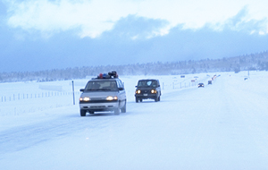
Weather is the second largest cause of non recurring congestion, accounting for 25 percent of all non recurring delays. Drivers endure close to one billion lost hours due to delays caused by snow, rain, ice, wind, and fog on an annual basis.
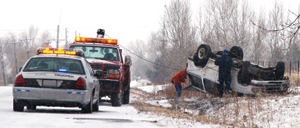
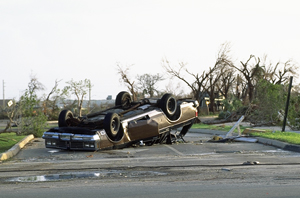
Weather is more than aggravating, it is dangerous. Weather plays a role in 25 percent of total crashes – approximately 1,511,000. A 14-year average between 1995 and 2008 indicates 7,400 people are killed and over 629,000 are injured in weather-related crashes each year. The annual economic cost of these deaths and injuries is estimated at $42 billion. In addition, state and local agencies spend more than $2 billion per year on snow and ice removal alone!
- The Utah Department of Transportation reported the statewide use of ESS saved $2.2 million in labor and materials for snow and ice removal, a benefit-to-cost ratio of 10:1.
- In Minnesota, the I-90 freeway gate closure system reduced roadway clearance costs by 18 percent.
- Implementation of an anti-icing program in northern Idaho reduced winter maintenance labor hours by 62 percent, decreased abrasives usage by 83 percent, and resulted in an 83 percent decline in winter crash frequency.
Crashes
- In Denver, Colorado, anti-icing on Interstate freeways reduced snow and ice related crashes by 14 percent.
- North Carolina reported the use of wet pavement warning systems reduced crashes by 39 percent.
- An automatic bridge anti-icing system in Utah reduced crashes by 64 percent.
- In Tennessee, over a 20-year period I-75 had experienced over 200 fog-related crashes. After installation of a fog warning system, the number of crashes was reduced to only one between 1994 and 2003.
Travel Time
- In surveys conducted by the Washington State Department of Transportation (DOT) on improved Road Weather Information Systems and Highway Advisory Radio (HAR), 94 percent of travelers surveyed indicated a road weather information web site made them better prepared, and 56 percent agreed the information helped them avoid travel delays.
- In Oregon, approximately 90 percent of motorists surveyed indicated they would slow down in response to messages displayed by an automated high wind warning system.
Source: RITA Intelligent Transportation System Benefit Database, http://www.itsbenefits.its.dot.gov/its/benecost.nsf/.
SAFETEA-LU Requirements

The U.S. Congress recognized the importance of an effective national road weather program and established requirements in the Safe, Accountable, Flexible, Efficient Transportation Equity Act – A Legacy for Users (SAFETEA-LU). Through the Intelligent Transportation Systems (ITS) Research program managed by the U.S. Department of Transportation’s RITA, the Program is directed to accomplish the following:
- Maximize the use of available road weather information and technologies;
- Expand road weather research and development efforts to enhance roadway safety, capacity, and efficiency while minimizing environmental impacts; and
- Promote technology transfer of effective road weather scientific and technological advances.
To meet these objectives, the Program developed a plan to guide efforts in several key areas, including:
- Stakeholder coordination;
- Road weather research and development;
- Technology transfer, training, and education; and
- Performance management and evaluation.
Within a short period of time, the Program has made remarkable progress in each of the identified areas as evidenced by the following achievements:
- Based on interviews with state DOT agencies, 82 percent of the 22 respondents reported involvement with at least one of the Program’s projects, and 64 percent said their agencies were involved with both the Clarus road weather observation initiative, and the Maintenance Decision Support Systems (MDSS) initiative. In each of these instances, the Program is enhancing road weather data and turning it into decision support tools for public and private agencies that rely on high-quality weather information.
- Between 2004 and 2007, the number of states providing weather information, either through Dynamic Message Signs (DMS), HAR, 511 phone system, or a traveler web site increased by 42 percent. The largest increase involved weather information on DMS (84 percent increase).
- In 2008, 33 states had 41 operating 511 travel information phone systems, and 25 of those offered some weather or road weather information. Based on reports from 38 systems, an estimated 13 million calls sought weather or road weather information.

The accomplishments underscore the importance of a targeted approach to address the impacts of weather on surface transportation with a focus on reducing congestion and saving lives. Guiding the Program are recommendations from the National Research Council report “Where the Weather Meets the Road: A Research Agenda for Improving Road Weather Service.”
According to the report, “High-quality weather observations and forecasts specific to the roadway environment could help users, including drivers, fleet dispatchers, and law enforcement and emergency management personnel make better decisions, thereby increasing travel efficiency and safety during adverse weather conditions. Improved road weather information could also help those who construct, operate, and maintain the roadways to better respond to weather problems.”
This report details the accomplishments of the Program over the past several years during the SAFETEA-LU period in achieving “Anytime, Anywhere Road Weather Information.” Such a concerted effort to alleviate the impacts of weather on the surface transportation system has resulted in improved safety and mobility for all road users.
Stakeholder Coordination
An enhanced road weather program requires a unique partnership among the public and private sectors, the transportation and weather communities, and operations and research personnel to achieve a multi-disciplinary approach to problem solving.
Accomplishments
National Oceanic and Atmospheric Administration (NOAA)
National Weather Service (NWS)
Office of the Federal Coordinator for Meteorology (OFCM)
Office of Oceanic and Atmospheric Research (OAR)
National Science Foundation (NSF)
American Association of State Highway Transportation Officials (AASHTO)
The American Meteorological Society (AMS)
The Intelligent Transportation Society of America (ITS America)
State Departments of Transportation (DOT)
World Road Association (PIARC)
The Standing International Road Weather Commission (SIRWEC)
Environment Canada
Transportation Research Board (TRB)
Institute of Transportation Engineers (ITE)
- Established a formal relationship with NOAA through a Memorandum of Understanding, which expresses a willingness of the parties to work together on common goals. Developed a joint FHWA/NOAA Partnering Plan to guide research, development, and deployment projects related to surface transportation weather.
- Set national priorities and policies for road weather information as co-chair of the OFCM’s Weather Information for Surface Transportation (WIST) Working Group. WIST brings together a diverse group of Federal agencies with expertise in the fields of transportation, research, safety, environment, energy, national security, agriculture, and aviation.
- Built coalitions with public and private sector agencies and organizations, and academic institutions across the transportation and weather communities. A characteristic of the Program is the ability to turn research results into useful products and tools that are used by the private sector and their customers. The Maintenance Decision Support Systems (MDSS) initiative is a good example.
- Conducted over 90 road weather projects through Federal and state agencies and academic institutions resulting in unique road weather products for the public and private/commercial sectors including Clarus; MDSS; Condition Acquisition and Reporting System (CARS), which helps agencies acquire and report on weather and traffic conditions and traffic congestion; WeatherShare, which streamlines and integrates road weather data; and #SAFE.
- Focused efforts on diverse audiences including transportation operations managers, traffic management center personnel (TMC), traffic safety managers, road users, meteorologists and other scientists, researchers and practitioners, the commercial weather industry, rail and air modes of transportation, and the freight industry.
- Shaped broader transportation and weather programs to incorporate surface transportation weather through participation in panels, working groups, and committees. The Program successfully incorporated the concept of a network of surface transportation weather observations into the National Research Council’s report “Observing Weather and Climate from the Ground Up: A Network of Networks.”
- Shared solutions with international partners via PIARC, SIRWEC, the Transportation Association of Canada, and scan tours, which give practitioners from the U.S. an opportunity to “scan” programs in other countries to identify best practices that can be implemented in the U.S.
Road Weather Research and Development
The Program advances excellence in road weather plans and activities through targeted, coordinated road weather research and development in four areas: Observing, Modeling, Road Weather Information Dissemination, and Integrated Road Weather Technologies.
Accomplishments
Clarus, the Latin word for clear, is a Program initiative that provides clear, relevant information on roadway conditions to all transportation managers and users.
Clarus is the 21st Century’s answer to the need for timely, high-quality road weather information. Through Clarus, the collection of weather observations from weather and transportation sources results in valuable road weather information.
Clarus fills the gaps in present day observation networks by focusing on the road surface where vehicles are located and not just on the atmosphere used in most weather forecasts and products. The result is a more complete, accurate weather picture that is available to any user, at any time, anywhere in the U.S.
Between 2006 and July 2009, the number of transportation agencies contributing their ESS data to Clarus increased from three to 39 which reflects the value of easy access to quality controlled data from a variety of sources. As of July 2009, 42,000 individual sensors are supplying data from 1,897 ESS to support Clarus. Of the 2017 ESS that are operating in the U.S., 1,897 or 94 percent are connected to Clarus.
- Clarus – The Program developed the Clarus System to provide quality checked road weather observations to state DOTs and to the commercial and public, i.e., NWS, weather industry. The Program is reaching out to all state and local DOTs to create a seamless road-weather data collection, processing, and dissemination system thereby creating a unique data set not duplicated by any other agency or organization.
Clarus uses data from environmental sensor stations (ESS), which measure atmospheric conditions, pavement conditions, and/or water levels, and can include cameras, precipitation detectors, etc. The Program developed ESS siting guidelines to help states with equipment placement, maintenance, and other tasks. To pave the way for Clarus implementation, the Program also began a multi-phased regional demonstration where state and provincial departments of transportation provided ideas for five new potential uses for Clarus data that are being implemented by two public/private sector partnerships.
- IntelliDriveSM Enabled Road Weather Products. IntelliDriveSM combines advanced wireless communications, on-board computer processing, access to vehicle-sensors, GPS navigation, and smart infrastructure to provide the capability for vehicles to identify threats and hazards on the roadway and communicate this information over wireless networks to drivers through alerts and warnings. The Program is developing a translator that will take data from the vehicle and provide valid road weather information for travelers.
- Weather Responsive Traffic Management (WRTM). WRTM focuses on advisory strategies to provide warning and other information to travelers and control strategies to regulate or optimize traffic flow. The Program developed weather-sensitive traffic models to help traffic managers understand the effects of weather on traffic flow and implement management strategies that respond to current and anticipated conditions along with recommendations on content for drivers.
The Program developed a Self-Evaluation and Planning Guide to help DOT traffic managers integrate weather information into their TMCs and proactively operate the roadway network. The guide helps managers identify weather events that affect operations; assess critical weather impacts; identify existing levels of weather integration in the TMC; prioritize TMC operational needs to respond to weather events; implement strategies for integrating weather information; and gather additional information for a weather integration plan.
Technology Transfer, Training, and Education
Through technology transfer, outreach, training, and education the Program aims to enhance road weather capabilities to an expanded transportation and weather constituency in the public and private sectors.
Accomplishments
When state DOTs gear up to handle an expected winter storm, they do more than make sure the snow plows are ready to roll. Decisions are needed on the type of treatment to apply, what chemical regulations must be followed, and ways to minimize the potential impacts to the environment.
In the past, there was no link between weather forecasts and the information needed by winter maintenance managers. To correct this situation, the Program developed the winter MDSS.
The MDSS takes state-of-the-art weather forecasting and data from sensors in and around roadways and merges them with computerized winter road maintenance rules of practice. The result is guidance that provides treatment recommendations customized for specific routes, and based on forecast of surface conditions.
- The Indiana DOT reported the use of MDSS has saved over $12 million in salt usage, and over $1.3 million (58,274 hours) in overtime.
- Maintenance Decision Support Systems (MDSS) are state-of-the-art solutions that provide winter maintenance treatment recommendations to maintenance managers based on route-specific predicted weather and pavement conditions and an agency’s snow and ice control policies. Forty-one states participate in some way, and 16 have pooled resources to utilize the technology.
Two critical aspects of the MDSS developmental strategy worth highlighting include the leveraging and market building strategies which enabled the results of the initiative to be bigger and broader than a typical research effort. The core MDSS modules leveraged millions of dollars of research results from similar disciplines such as aviation weather. Likewise, the Program’s products were published as a prototype in an open source format and made available to anyone in the private, public, or academic sectors to use and build into their own MDSS versions.
To promote MDSS, the Program, AASHTO, FHWA’s Resource Center, the national Local Technical Assistance Program, and several state DOTs sponsored a series of one-day product demonstration showcases which highlighted the benefits of MDSS based on evidence from two demonstration projects in Colorado and Illinois. Representatives from the private sector also provided details on the program requirements followed by a panel discussion on MDSS deployment.
- Best Practices. The Program maintains a database of 30 case studies that highlight successful road weather management practices used throughout the U.S. to improve roadway operations under inclement weather conditions. The case studies describe the system components, the operations element, the benefits, any issues associated with implementation, and contact information.
- Training Courses. The Program developed four training courses for weather and transportation professionals that cover ways to alleviate the impacts of adverse weather on the surface transportation system. A course on weather and road management informs transportation personnel about National Weather Service products, forecasts, and warnings, and a companion training course helps NWS forecasters understand the needs of the transportation community. Other courses address the principles and tools for road weather management, and how road weather information systems can improve the safety and operation of the transportation system.
Performance Management and Evaluation
Program objectives in the area of performance management and evaluation include defining performance measures for safety, mobility, and efficiency; establishing baseline conditions; and tracking performance based on the measures.
Accomplishments

Road Weather Management Performance Measures. The Program established meaningful, understandable, and practical measures of performance to evaluate the social, scientific, and organizational benefits of Program products and activities such as Clarus, MDSS, and WRTM. These measures provide the Program with a powerful tracking mechanism to monitor overall program performance and progress towards achieving SAFETEA-LU goals. The measures include the following:
Goal 1: Maximize use of available road weather information and technologies.
- Number or percentage of transportation agencies that use road weather information and decision support systems for making advisory, control, and treatment decisions.
- Between 2004 and 2007, the number of states providing weather information, either through DMS, HAR, 511 phone system, or a traveler web site increased by 42 percent. The largest increase involved weather information on DMS (84 percent increase).
- By 2007, 47 states reported using atmospheric weather data and 46 reported using pavement data.
- Between 2004 and 2008, 30 state agencies reported some use of MDSS. Of those states, 5 reported full operational use as part of their regular winter maintenance operations and decision support.
- Between 2004-2007 the number of states that subscribed to road weather products and services increased by 26 percent.
- Number or percentage of travelers who use road weather information for making travel decisions.
- In 2008, 33 states had 41 operating 511 travel information phone systems, and 25 of those offered some weather or road weather information. Based on reports from 38 systems, an estimated 13 million calls sought weather or road weather information.
- Number of ESS deployed and used by transportation agencies to support decision-making.
- Between 2006 and July 2009, the number of transportation agencies contributing their ESS data to Clarus increased from 3 to 39 which reflects the value of easy access to quality controlled data from a variety of sources. As of July 2009, 42,000 individual sensors are supplying data from 1,897 ESS to support Clarus.
Goal 2: Expand road weather research and development efforts.
- Number of agencies participating in and benefiting from road weather research and development projects.
- Based on interviews with state DOT agencies, 82 percent of the 22 respondents reported involvement with at least one of the Program’s projects, and 64 percent said their agencies were involved with both Clarus and MDSS.
- Percentage of time a roadway meets safety and capacity level of service (LOS) standards during and after weather events.
- Reduction in agency costs due to adoption of maintenance and operations decision-support systems for road weather management.
- The Indiana DOT reports normalized savings of almost $10 million in salt used during the 2008-2009 winter season and almost $1 million in overtime compensation savings.
- Reduction in traffic related crashes due to improved road weather advisory, control, and treatment strategies.
- Data compiled by the Program indicate average speeds on roadways are reduced between 3 percent and 40 percent by weather ranging from light rain to heavy snow. Following are the impacts of various Program strategies on speed, capacity, and delays. (The following tables show the estimated reduction in crashes in 2007 experienced by states that have deployed a Program best practice.)
Goal 3: Promote technology transfer of effective road weather scientific and technological advances.
- Number of agencies/individuals visited or contacted through technology transfer, training, and outreach efforts.
- Involvement in the Clarus initiative has increased from 3 states to 33. Since 2000, 41 state DOTs have participated in one or more MDSS stakeholder meetings.
- Four training courses on “Principles and Tools for Road Weather Management” have been attended by 113 participants, and two additional courses drew 38 attendees in 2008.
- Rate of adoption of Program technologies by agencies that participate in workshop or training activities.
- Number of Program technology development, testing, and deployment activities initiated through public or private sectors.
- Between 2001 and 2008 approximately 90 projects have been initiated through Federal, state, and university sponsorship.
- Number of road weather technologies that reach operational deployment.
- Eight technologies developed through Program partnerships have reached the operational level, including the CARS, Weather Response Index, MDSS, WeatherShare, and #SAFE.
| Best Practice | Percentage Reduction in Crashes |
|---|---|
| Fog Warning System | 70-100% |
| Road Weather Information System | 3-17% |
| Variable Speed Limits | 8-25% |
| Anti-icing Strategies | 7-83% |
| Wet Pavement Detection | 39% |
| Automated Anti-icing on Bridges | 25-100% |
| Strategy | Impact |
|---|---|
| Low Visibility Warning Systems | Reduced speed variability by 22 percent |
| Highway Advisory Radio | One-third of commercial vehicle operators considered changing routes based on information |
| Variable Speed Limits/Speed Management | Reduced average speed by 13 percent |
| Weather-related Signal Timing | Reduced vehicle delay by 8 percent Reduced vehicle stops over 5 percent |
| Weather and/or Road Condition Information on Web Sites | 94 percent of travelers reported they were better prepared 56 percent of travelers reported the information helped avoid delays |
While it may not be possible to do anything about the weather, minimizing the adverse impacts weather conditions have on the safety and operation of the nation’s roads is possible. The Program is dedicated to providing information, tools, and resources that can help surface transportation users and managers respond to weather events with effective and efficient strategies and programs. The Road Weather Management Program:
- Improves safety by reducing crash risk, increasing awareness among agencies and users, and restoring safer driving conditions quicker and more efficiently.
- Increases mobility by restoring capacity, reducing delays, and creating more uniform traffic flow; and
- Increases productivity by reducing labor, treatment, and equipment costs.
To learn more about the Road Weather Management Program, visit the Program web site at http://ops.fhwa.dot.gov/Weather/index.asp.

For more information, Contact:
Paul Pisano
Team Leader, Road Weather Management
FHWA, Office of Transportation Operations
202-366-1301
E-mail: paul.pisano@dot.gov
Publication #: FHWA-JPO-10-004
EDL #: 14506
