
4.0 The Demonstration Sites
The demonstration sites represent several operational environments (urban, suburban, small urban, rural), have different types of lead agency organizations (Metropolitan Planning Organizations [MPOs], transit agencies), which play different roles in human service transportation (planning, coordination, service providers, brokerage). Together, these demonstration sites provide an excellent range of test-beds to develop and pilot new approaches to developing a scaleable and replicable model of coordination. Some of the high-level site characteristics of the demonstration sites are summarized below.
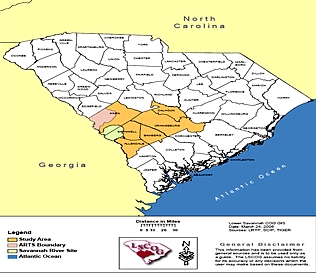
Aiken – The TMCC project is led by Lower Savannah Council of Governments (LSCOG), a regional planning organization, in the six-county region in central and western South Carolina. Predominantly rural in nature, the geographic scope for this task covers a service area of 3,891 square miles and an approximate population of 300,266 (2000 census). There are 45 municipalities in the region.
Project partners include – LSCOG, Lieutenant Governor’s Office of Aging, South Carolina Department of Transportation, RouteMatch™, American Medical Resources, Bill Doyle of ISG, and McLary Management.
Transportation services in the region include mostly paratransit and shared ride operations in four of the six counties. Most of the transportation is provided by human service agencies except one small urban area in the region where an out-of-region transit authority provides urban fixed route services.
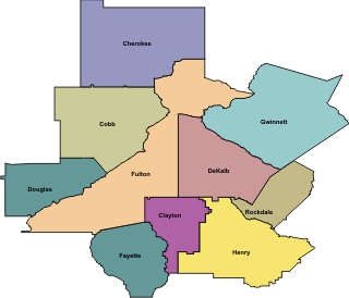
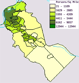
Atlanta – The TMCC design development is being led by the Atlanta Regional Commission (ARC), the regional planning and inter-governmental coordination agency in the 10-county Atlanta region. ARC estimates that the 2005 population of the region is 3.81 million with approximately 1.2 million people living in poverty, disabled or over 65, and potentially transportation disadvantaged.
The project team comprises of staff from ARC and a consultant team led by Cambridge Systematics.
Transportation services in the region include fixed route transit systems with paratransit (Metropolitan Atlanta Rapid Transit Authority, Canton Transit System, Cobb Community Transit, Clayton County Transit (C-TRAN), Gwinnett County Transit), regional circulators and campus shuttles (Buckhead Shuttle, Emory/Clifton Corridor Shuttle, Georgia Tech, Georgia State), commuter buses, regional vanpools, on-call services for seniors, private and non-profit on-demand car, van, and bus services.
Camden – The Freeholders of Camden County (the main elected governing body of the County) have designated the Camden County Workforce Investment Board (CCWIB) to lead this project. This project will be based in Camden County, NJ. Camden County is the eighth-most populated county in New Jersey with 508,932 residents in 222.3 square miles. The primarily suburban county has a population density of 2289.4 persons per square mile.
The CCWIB along with the Alan M. Voorhees Transportation Center (VTC) at Rutgers University comprise the project design team for this project. VTC has led several state transportation planning efforts and is an active participant in the New Jersey Council on Access and Mobility (NJCAM). VTC will provide technical expertise, research, and analytical support. The project also includes a consultant hired specifically for facilitation skills.
Transportation resources in the region include New Jersey Transit, the largest public transit system in the nation and one of the few state-wide systems. They operate the state-wide bus and rail system and the paratransit AccessLink. NJ Transit has 23 bus routes and 2 rail lines throughout the County linking most population centers. AccessLink serves 80,000 annually in the County. Also included in the TMCC will be independent for- and non-profit operators, such as Title XIX (medical) transportation providers providing 11,500 annual rides, taxis, for-profit transportation providers and local NGO and hospital vans. Other resources include PATCO rail service, human service transportation provided by South Jersey Transportation Authority, municipalities, faith-based communities, and senior centers.
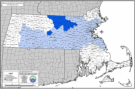
Fitchburg – The TMCC design project is led by Montachusett Area Regional Transit (MART), a transportation provider and brokerage. MART services cover the Massachusetts cities of Fitchburg, Leominster, Garner and several neighboring cities—as represented in dark blue in the following map. MART also is the transportation broker for three agencies represented by the Massachusetts Human Service Transportation (HST) office. The service provided through MART coves a vast portion of the State, as represented in light blue in the map. In total, MART serves 18 communities and a total of over 92,000 households.
The project design team consists of staff from MART and HBSS, a transportation software systems provider and integrator.
MART operates services six days/week, and Sunday service for its brokerage operations including subscription and demand responsive services, fixed route, ADA paratransit service, and dial-a-ride services.
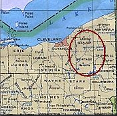
Kent – The TMCC design for the 2-county region in northern Ohio (Portage and Geauga counties) team is led by the Portage Area Regional Transit Authority (PARTA) and Geauga County Transit (GCT). Portage County, with an area of 507 square miles and a population of 152,061 (2000 census) would best be described as small urban and rural in character. Geauga County is smaller both in population and population density and is a rural county in terms of transportation.
The project team, in addition to the transit providers, includes Trapeze and Dave Kotting, an independent consultant. The team also includes consultant for facilitating the stakeholder interactions in the region.
Transportation resources in Portage County are primarily through PARTA and include services such as Dial-a-Ride, fixed route services, fixed routes with deviation, and contracted human service transportation.
Transportation resources in Geauga County are through Geauga County Transit, which provides door-to-door services and provides human service transportation to over 20 human services agencies.
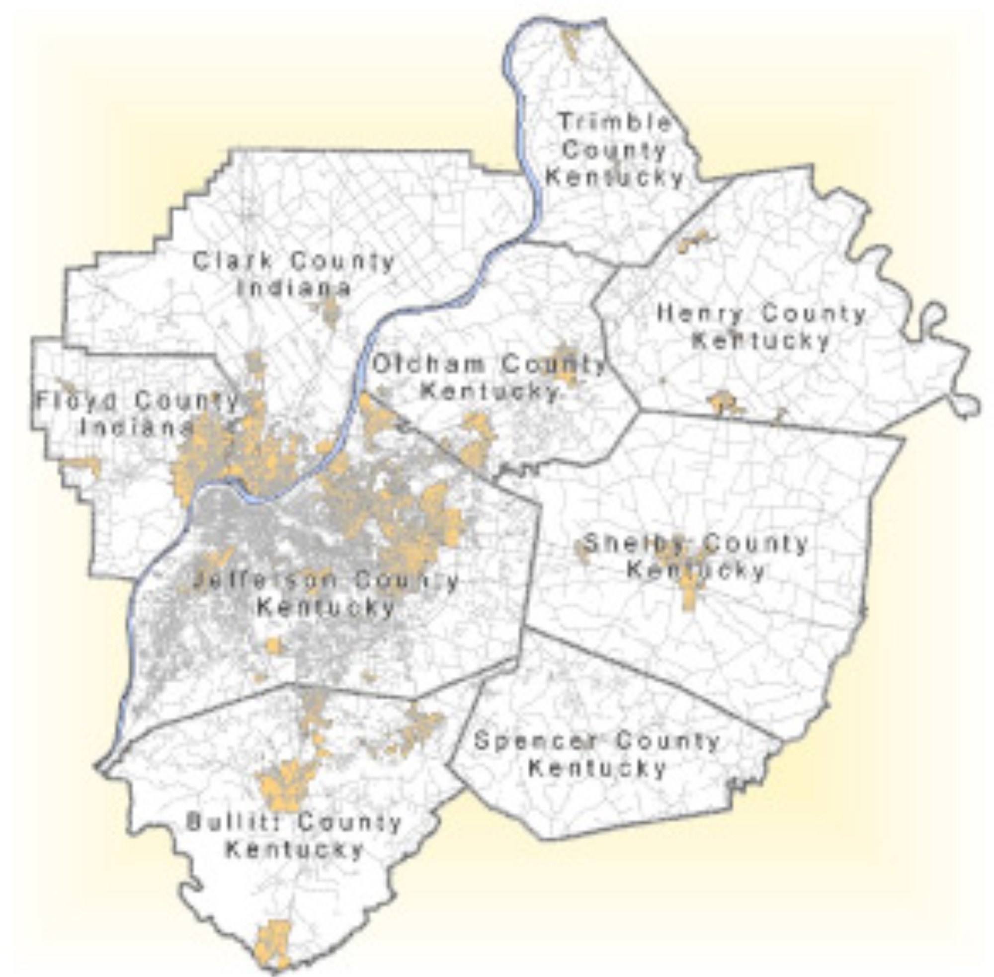
Louisville – The Transit Authority of River City (TARC) is the primary lead agency for the TMCC project. The secondary lead agencies are Louisville Metro’s Cabinet for Human Services and Kentuckiana Regional Planning and Development Agency (KIPDA), which will be assisting TARC. The geographic scope of the TMCC project will be the Louisville metropolitan region, which consists of the nine-county region served by KIPDA, the metropolitan planning organization. This region in north central Kentucky is slightly larger than the Louisville metropolitan statistical area (MSA) and includes two adjacent counties in southern Indiana, and seven north central Kentucky counties. According to the 2000 U.S. Census, Jefferson County is the largest of these counties with an estimated population of 693,604. The largest city in the region, Louisville, has a population of 26,307. Jefferson County covers a total of 385 square miles. Overall, the Louisville metropolitan region has a total population of approximately 1,036,601 and encompasses an area of about 2,404 square miles.
In addition to the three agencies, the project team will also include the Regional Mobility Council, consisting of a previous established group of human service and transportation providers in the Louisville area who will be serving as an advisory arm. RouteMatch™, a vendor who has provided software to TARC in the past, will round out the project team.
Transportation resources in the region include Transit Authority of River City (TARC), which operates fixed, and paratransit services in the region, and private for- and non-profit providers, such as the American Red Cross and Yellow Cab.
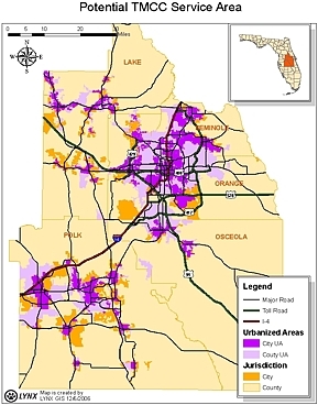
Orlando – The Model Orlando Regionally Efficient Traveler Management Coordination Center (MORE-TMCC) development is being led by the Central Florida Regional Transportation Authority known as LYNX.
The MORE-TMCC will serve a five county area, with Orlando serving as the major central urban area. The five counties are Polk, Osceola, Orange, Seminole, and Lake. In total, the current human service providers in these counties cover approximately 2,661 square miles with about 168 vehicles. The goal is to expand this coverage area to 5,364 square miles.
The providers and services under the MORE-TMCC will include fixed and paratransit operations of LYNX, the Citrus Connection (Lakeland County), Lakeland Area Mass Transit District, Polk County Transit Services, and MV Transit.
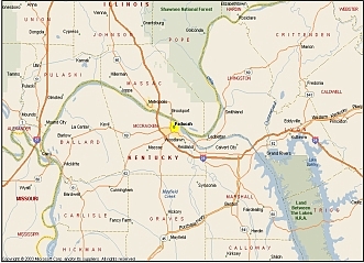
Paducah – The Paducah Area Transit System (PATS) is leading the TMCC efforts for the City of Paducah and McCracken County. The city of Paducah has a population or 26,307 and the entire McCracken County has a population of 65,514. In addition to the core region, upon the award of the Medicaid Transportation Brokerage by the KYTC in 1999, PATS expanded their coverage area to an eight county service area for Medicaid-eligible customers.
The project team comprises of PATS staff, RouteMatch™ and the Call Center Technical Advisory Committee (CCTAC)—a committee to set up and guide the operations of the existing call center managed by PATS.
PATS operates fixed route and paratransit services, airport shuttles, dial-a-ride services, veteran connector services, the Paducah trolley service, and a vanpool service. PATS also provides human service transportation for over 16 organizations, including the KY Medicaid Transportation Program, for an eight county region.